 DexAI
DexAI01 — High-Precision Computer Vision
RoadTwin AI — Automated Road Digital Twin Platform
Client: Road Infrastructure Management Company
An automated digital twin platform that uses AI to analyze point cloud data and vehicle-mounted camera imagery, recreating real road space in 3D. It answers the reliance on manual work — field surveys, drawing production, register updates — and the fragmentation of road data across systems, through AI-driven automatic recognition and 3D structuring.
Challenges
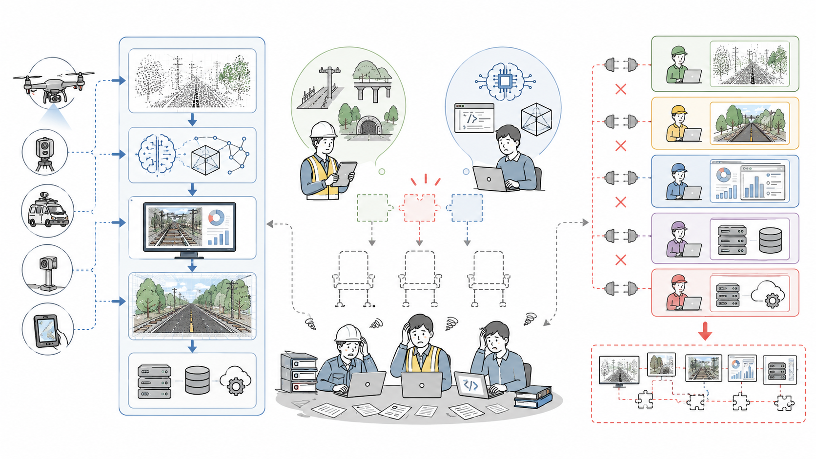
Road maintenance and design work relied heavily on manual effort — field surveys, drawing production, register updates — while road data scattered across multiple systems and documents made it slow to grasp current conditions or share information.
- Vast point cloud and image data from mobile mapping systems and drones sat unused due to the effort required for processing and cleaning
- Extracting features like guardrails, signs, lane markings, and traffic lights was manual — causing inconsistency between engineers, long lead times, and chronic cost overruns
- 3D models and attribute data such as registers were disconnected, falling short of a living digital twin usable for design and maintenance decisions
- No in-house capability spanned point cloud processing, AI implementation, and web visualization — and piecemeal outsourcing left systems disconnected
AI Automatically Structures Road Information
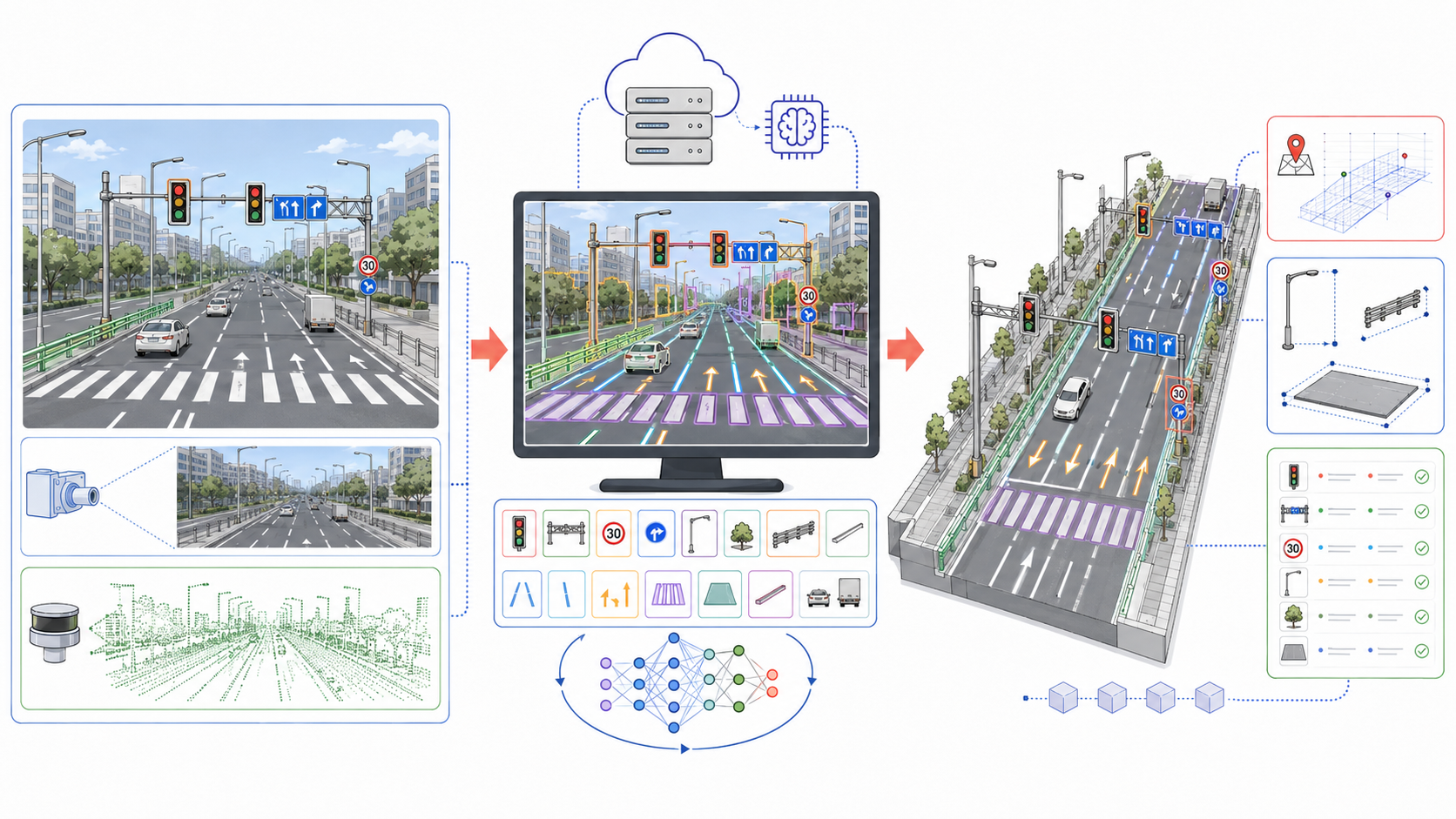
AI models extract the many elements that make up a road from imagery and point clouds — lanes, lane markings, road boundaries, road width, longitudinal and cross gradients, directional arrows, stop lines, pedestrian crossings, and more. Each element's position, shape, orientation, and type is converted into data and managed as road information that can be searched, measured, compared, and updated.
Leveraging the Strengths of Point Clouds and Imagery
Point cloud data excels at capturing a road's three-dimensional shape, elevation, and gradients, while camera imagery carries visual information such as lanes, arrows, text, and surface markings. RoadTwin AI combines both to generate highly practical 3D models that unify road geometry with semantic information.
Making Road Management More Efficient
On the digital twin, road geometry can be reviewed and distances, widths, heights, and gradients measured without traveling to the site. Comparing against past data also reveals changes in the road environment. This cuts the time spent on field surveys and documentation, supporting maintenance, repair planning, design, construction, and traffic safety work.
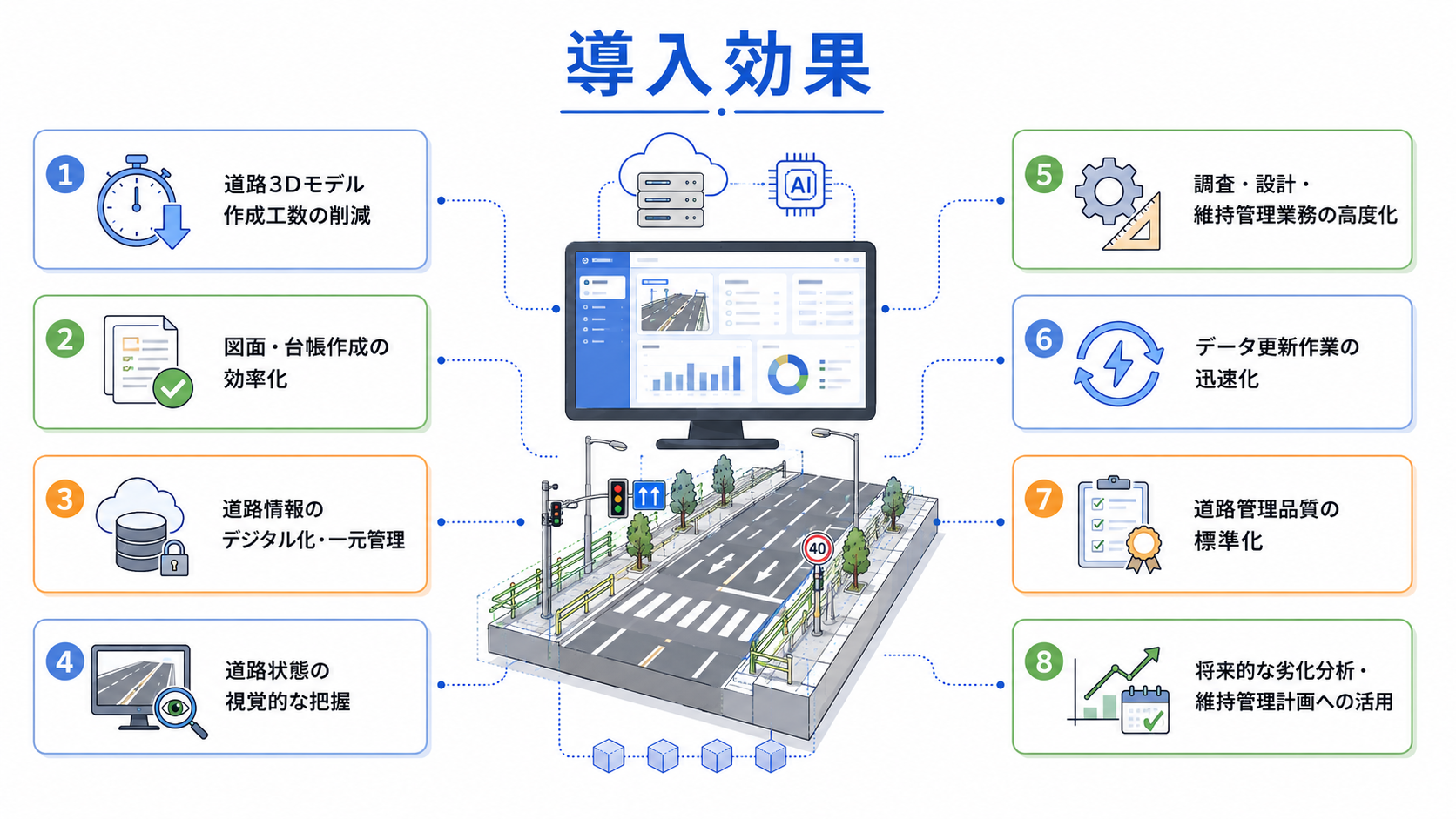
- Reduced effort for creating road 3D models and more efficient production of drawings and registers
- Digitized, centrally managed road information with visual insight into road conditions
- More sophisticated survey, design, and maintenance work with faster data updates
- Standardized road management quality, with future applications in deterioration analysis and maintenance planning
Outcomes & Value
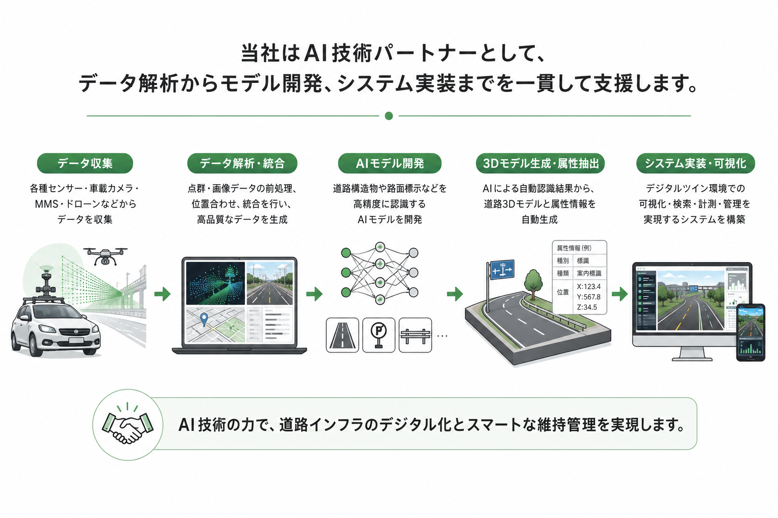
As an AI technology partner, we design systems tailored to each client's data characteristics and operational requirements — providing end-to-end support that spans not only AI model development but point cloud and image processing, 3D model generation, accuracy evaluation, visualization interfaces, and integration with existing systems. Deployments can begin as small proof-of-concept trials and expand progressively in coverage area and recognition targets. Beyond road maintenance, the digital twins RoadTwin AI generates hold promise as future social infrastructure — powering smart cities, disaster prevention, traffic planning, autonomous driving, and high-definition maps.
Facing a similar challenge? We'd love to hear from you.
Contact us